Follow a chapter or choose a numbered place on the map.
BEFORE THE TOWN LINES
A landscape already full of history.
The boundaries on this map show today’s community geography. They do not describe Indigenous territories or the extent of earlier settlements.
04
ACROSS MINNESOTA
Follow a thread. Find a wider story.
Local heritage reaches beyond the town line. Follow eight stories through 13 places, from Dayton and the Twin Cities to central Minnesota, Duluth, and Winona–Rochester.
Cambridge belongs to both views: its local history opens into a wider parish network. These local and regional views connect with the statewide guide below.
Lines connect places in a documented relationship or shared geographic theme. They are schematic, not travel routes, migration tracks, or jurisdiction boundaries.
Historical institutional connection
Benedictine roots: St. Cloud to Duluth
1857 · 1863 · 1881 · 1892
A documented movement of people connects these communities. The sisters founded their St. Cloud convent in 1857 and moved to St. Joseph in 1863. Sisters from that community began work in Duluth in 1881; a separate Duluth foundation followed in 1892.
Follow schools, health care, archives, and the relationships created by Benedictine service across central and northeastern Minnesota.
The foundation relationship does not make the two monasteries one institution today.
Alexandria’s St. Mary, Fergus Falls’ Our Lady of Victory, and Cambridge’s Christ the King are all listed by the Diocese of Saint Cloud. St. Joseph and Collegeville add monastic and educational institutions within the same central Minnesota setting.
Parish records, diocesan archives, schools, and Catholic Charities offer distinct ways to study community life across these places.
Shared diocesan membership does not establish a shared pastor, a merged parish, a family migration, or a Spark House partnership.
Dayton’s St. John the Baptist belongs to the Archdiocese of Saint Paul and Minneapolis. Its French-speaking parish beginnings connect local river settlement with a larger archdiocesan history of immigrant communities, education, and care.
Dayton’s parish history identifies food-shelf involvement and a parish festival as continuing expressions of community relationships.
This joins a local parish to its archdiocese; it does not place the other Minnesota dioceses inside today’s archdiocesan territory.
2003 cluster · separate pastor at St. Albert since 2021
St. Albert’s official history records a 2003 cluster with St. John the Baptist in Dayton, sharing a pastor. The same history says St. Albert has had its own pastor since 2021.
Parish histories can reveal relationships across town lines that a city map alone misses.
The former cluster is a historical link, not a claim about current parish administration.
The Cathedral of the Sacred Heart in Winona and the Co-Cathedral of St. John the Evangelist in Rochester serve the same diocese. The 2018 name change formally joined the two cities in the Diocese of Winona-Rochester.
The paired cathedral cities connect worship, diocesan gatherings, and the institutional history of southern Minnesota.
Rochester is an inland city; this institutional link is not a Mississippi River route.
St. Joseph–Collegeville: a shared educational community
Present-day CSB+SJU community
The College of Saint Benedict in St. Joseph and Saint John’s University in Collegeville describe themselves as two colleges with a shared Benedictine commitment. Their campuses are connected by the LINK shuttle and sit near St. Cloud.
Learning, campus traditions, and alumni relationships create a living connection alongside the older monastic history.
The colleges and their founding religious communities have distinct institutional identities.
The Saint Paul diocese dates to 1850 and its elevation to 1888. In 1875, Collegeville abbot Rupert Seidenbusch became vicar apostolic of Northern Minnesota and visited Duluth. Duluth became a separate diocese in 1889; that December, Winona’s first bishop was ordained in Saint Paul.
These linked histories explain institutional relationships that extend beyond today’s diocesan boundaries.
The lines summarize particular historical connections. They do not reconstruct the complete changing borders or chain of diocesan authority.
The Mississippi links the St. Cloud area, Dayton at the Crow River confluence, the Twin Cities, and Winona. Reading these places together offers a geographic starting point for researching settlement, work, trade, and community memory.
This is a research lens grounded in river geography, not evidence that a particular family followed this sequence.
The lines are schematic. The DNR reference provides watershed context; this view does not map Indigenous territories or historical travel routes.
Founded in 1856, the parish served a largely French-speaking population near the Crow–Mississippi confluence. Its history also records a school and continuing food-shelf and festival involvement with neighboring communities.
The Benedictine sisters established their Minnesota community here in 1857, then moved to St. Joseph in 1863. The city remains a center for a diocese extending across central Minnesota.
St. Mary in Alexandria is listed in the Diocese of Saint Cloud. That shared diocesan community provides a documented connection with Fergus Falls, St. Cloud, and Cambridge.
Our Lady of Victory belongs to the Diocese of Saint Cloud. Fergus Falls extends this view west into Otter Tail County while retaining its own local parish and community history.
St. Scholastica Monastery and the Diocese of Duluth
Sisters from St. Joseph began ministries in Duluth in 1881. An independent Benedictine community followed in 1892, continuing education and hospital work in the city.
Winona is a cathedral city with a direct institutional link to Rochester. The first bishop of Winona, Joseph Cotter, was ordained in Saint Paul in December 1889.
St. John the Evangelist became a co-cathedral when the diocese adopted the name Winona-Rochester in 2018. The two cathedral churches remain shared gathering places for diocesan life.
MinneapolisArchdiocese of Saint Paul and Minneapolis
Basilica of Saint Mary
The Basilica became a co-cathedral in 1966, when Minneapolis joined Saint Paul in the archdiocese’s name. That institutional connection reaches smaller communities such as Dayton.
Saint PaulArchdiocese of Saint Paul and Minneapolis
Cathedral of Saint Paul
The Diocese of Saint Paul was established in 1850 and elevated to an archdiocese in 1888. Its history connects immigration, schools, hospitals, and service institutions across the region.
Saint Benedict’s Monastery and College of Saint Benedict
The sisters moved here in 1863. Their educational work developed into the College of Saint Benedict in 1913; their daughter foundations include St. Scholastica Monastery in Duluth.
Saint John’s University and the College of Saint Benedict share an educational community across two nearby campuses. The abbey’s first abbot, Rupert Seidenbusch, later served the Northern Minnesota vicariate.
AlbertvilleArchdiocese of Saint Paul and Minneapolis
St. Albert parish
The parish history records a shared pastor with Dayton beginning in 2003. It also states that St. Albert has had its own pastor since 2021, so that earlier cluster is shown as a historical relationship.
Christ the King appears in the Saint Cloud parish directory. Cambridge connects this wider diocesan view to the Atlas’s original East Central Minnesota stories and nearby Isanti.
Approximate community centers for regional orientation. These points do not identify building entrances, municipal boundaries, Indigenous territories, or diocesan boundaries. Cambridge retains its original USGS community point.
Point colors show present diocesan affiliation, checked September 13, 2026. Religious orders, colleges, parishes, and dioceses are distinct organizations.
These selected connections do not establish a Spark House partnership or describe everyone’s beliefs. Religious and settler histories are part of a longer landscape: read the Indigenous regional context.
Begin in Isanti, Emily or McGregor. Follow the rivers, cross the portages, and see how Catholic institutions grew within a landscape already rich in Indigenous history.
Three focal communities · Four river sources · Eight trade corridors · Six Latin dioceses · Nine cathedral or basilica buildings.
This guide uses historical interpretation and modern geographic reference layers. Rivers, trade networks and Church jurisdictions describe different kinds of relationships. None represents everyone’s heritage, faith or present-day affiliation.
Focal community · Diocese of Saint Cloud
Isanti
Rum River, local memory and shared parish life
Start with Isanti's existing local story, then follow the Rum River upstream to Mille Lacs and downstream to the Mississippi. The guide connects local settlement, timber-era change and living community heritage to a watershed shared with Cambridge and Anoka.
St. Elizabeth Ann Seton Catholic Church — The parish joined the shared Isanti Area Catholic Community with Christ the King in Cambridge and Sts. Peter and Paul in Braham in 2014, following the Cambridge–Braham partnership of 2013. The community shares pastoral resources and ministry.
Guide prompt: Which memories, photographs and family records show how bridges, rail and highway access changed where Isanti residents worked, worshipped and gathered?
Emily provides a lake-country focal point in Crow Wing County. The city's own history describes Indigenous dwellings and later logging and ricing. Its heritage is best approached through lakes, seasonal livelihoods and community records, with the Pine River watershed supplying wider geographic context. Emily is a lake-country focal point, rather than the headwater of one of the four featured rivers.
St. Emily Catholic Church — Established in Emily in 1951, St. Emily serves Minnesota’s lake country. The parish identifies itself as part of the Northern Lakes Catholic Mission Field with Immaculate Heart in Crosslake and Our Lady of the Lakes churches in Pequot Lakes, Nisswa and Pine River.
Guide prompt: Compare lakeshore livelihoods and community gathering places with present MN 6 and county-road access; invite local photographs and oral histories with permission.
Sandy Lake, the Savanna divide and living remembrance
McGregor is a gateway to the Big Sandy Lake and Savanna Portage landscape. Nearby, the historic Northwest Trail joined the Mississippi and Lake Superior drainage systems. The Sandy Lake Tragedy is essential to this history: the attempted removal and failed annuity distribution of 1850–1851 cost more than 400 Anishinaabe lives. The annual Mikwendaagoziwag commemoration expresses living remembrance and resilience.
Holy Family Catholic Church — Holy Family’s parish history records a church built in 1915, parish incorporation in 1938, Crosier ministry from 1948, and expansion in 1961–1962 for summer visitors. These changes connect McGregor’s parish heritage with regional travel and seasonal lake-country communities.
Guide prompt: Read the same landscape as a travel link, a place of forced displacement and a place of present-day remembrance. Use designated public memorial and park interpretation, rather than plotting sensitive sites.
Headwaters are places of knowledge, identity and environmental responsibility. A source marker is only a starting point: tributaries, wetlands and lakes sustain each river.
Lake Itasca → upper Mississippi → Twin Cities → lower Mississippi → Gulf of Mexico
Mississippi River
Headwaters: Lake Itasca / Mississippi headwaters
Lake Itasca is the recognized source of the Mississippi. Ojibwe leader Ozaawindib guided Henry Schoolcraft there in 1832; describing this only as a European discovery erases existing knowledge. Farther downstream, confluences gathered people, goods and power. At Bdóte, the Minnesota and Mississippi meet in a place central to Dakota history and origin traditions. At Owámniyomni, now also called St. Anthony Falls, industrial milling transformed a sacred river landscape.
Read the river as several connected histories: Indigenous homelands and knowledge, a commercial corridor, industrial transformation, and present cultural and ecological restoration. The modern river line cannot show the full historic channel or the social cost of changing it.
MN DNR modern water-trail geometry; approximate centerline from 2009 imagery, generalized for regional display. Rounded source-area vertex of Minnesota DNR water-trail geometry, objectid 58. Illustrative headwater point, not a surveyed monument location.
Mille Lacs Lake → Milaca → Princeton → Cambridge–Isanti → Anoka → Mississippi
Rum River
Headwaters: Mille Lacs Lake outlet
The Rum begins at Mille Lacs Lake and links the lake country to Anoka and the Mississippi. Minnesota DNR records the Dakota spiritual meaning attached to the river and the upper valley's deep archaeological history. Fur trading and then logging expanded Euro-American activity along its banks. Isanti belongs within this river story: the river connects its local heritage to Mille Lacs, Cambridge and downstream communities rather than ending at municipal borders.
The upstream source and downstream confluence make a useful guide pair: compare older water transport and seasonal land use with present bridges, roads and shared stewardship. Sensitive archaeological sites should remain described at landscape scale.
MN DNR modern water-trail geometry; approximate centerline from 2009 imagery, generalized for regional display. Upstream endpoint of MN DNR Rum River water-trail feature objectid 122; rounded to five decimals, approximate lake-outlet marker.
Upper St. Croix Lake, WI → Minnesota–Wisconsin border → Prescott → Mississippi
St. Croix River
Headwaters: Upper St. Croix Lake, Wisconsin
The St. Croix begins in Wisconsin before becoming a major Minnesota boundary river. It belongs in a story that crosses state lines. Its headwater connection to the north-flowing Bois Brule created a canoe-and-portage link between the Mississippi and Lake Superior. Dakota and Ojibwe communities and later fur traders used the network. Logging changed the commercial pattern: bulky timber moved downstream toward mills, while furs and trade goods could cross divides by portage.
A modern political boundary can also be an older corridor of exchange. Pair the Wisconsin headwaters with local St. Croix stories so the map does not imply the watershed stops at the Minnesota line.
MN DNR modern water-trail geometry; approximate centerline from 2009 imagery, generalized for regional display. The Wisconsin headwater reach is not included in the DNR line; its source-area marker is shown separately. Approximate outlet area; GNIS feature 662324 source coordinates reproduced in Wikidata Q1507416. DNR independently verifies source lake. GNIS public app retrieved but record API not independently parsed; do not label coordinate survey-grade.
Seven Beaver Lake → Floodwood → Cloquet → Duluth–Superior estuary → Lake Superior → Great Lakes–St. Lawrence → Atlantic
St. Louis River
Headwaters: Seven Beaver Lake
Seven Beaver Lake is the recognized source of the St. Louis River. The river turns southwest toward Floodwood and southeast to Lake Superior. Its lower rapids demanded portages on the historic link between the Mississippi basin and the Great Lakes. Later logging, railroads, iron-range industry and hydropower reshaped settlements and water use. The estuary also remains connected to Ojibwe life and manoomin, or wild rice, making restoration a cultural concern as well as an environmental one.
McGregor's nearby Savanna corridor explains why two river systems belong in one regional guide: people carried canoes across the divide that water itself could not cross. Distinguish historic trade, later extraction and present stewardship.
MN DNR modern water-trail geometry; approximate centerline from 2009 imagery, generalized for regional display. The headwater marker locates the Seven Beaver Lake area, not an exact source outlet. Approximate Seven Beaver Lake center, consistent with official DNR lake-reaching water trail. Not a surveyed outlet or furthest tributary source.
Indigenous canoe routes and portages connected drainage basins long before state highways. Métis cart routes later linked the Red River country with river ports. Select a corridor, then zoom into today’s highway and local-road map to compare the landscapes.
Dashed trade lines are interpretive corridors through documented places. Straight segments do not trace historical roads or portage paths. Modern river geometry supplies context for two water corridors; it does not reconstruct historical channels.
Indigenous networks; fur-trade era; nineteenth-century river ports
Mississippi exchange corridor
The Mississippi joined lake-country exchange with confluences and ports downstream. At the Minnesota River confluence, Dakota cultural geography and later Mendota trade intersected. St. Paul developed as a river port.
Modern water-trail geometry is a geographic reference, not a reconstruction of every historical channel or journey. This is an interpretive corridor, not a historical road survey or a recommended modern route.
This water connection places Isanti and Cambridge between Mille Lacs and the Mississippi. Fur trading and logging helped transform settlement along an already inhabited cultural landscape.
Do not show MN 65 or another present road as the historic river route. This is an interpretive corridor, not a historical road survey or a recommended modern route.
The Brule runs north to Lake Superior while the St. Croix runs toward the Mississippi. A portage at their headwaters connected the systems for Native travelers and fur traders.
Documented corridor places: St. Croix–Mississippi confluence → Upper St. Croix Lake → Brule headwater / portage area → Bois Brule mouth / Lake Superior
Connecting lines are schematic. Use mapped St Croix river geometry where available; the remaining dashed segments do not trace stream bends or the physical portage tread. This is an interpretive corridor, not a historical road survey or a recommended modern route.
Indigenous route; documented European travel in 1679; commercial fur-trade use
Sandy Lake–Savanna–St. Louis Northwest Trail
Travelers crossed from Sandy Lake and the West Savanna over the six-mile Savanna Portage to the East Savanna and St. Louis. Lower-river rapids required further portages before Lake Superior. McGregor gives readers a modern community entry into this cross-divide history.
Documented corridor places: Big Sandy Lake → Savanna Portage landscape → Floodwood / East Savanna–St. Louis junction → Cloquet → Fond du Lac / lower St. Louis → Duluth–Superior estuary
Approximate interpretive stops, not the exact trail or historic landing coordinates. The modern St Louis river layer can provide context. No claim that MN 65 or US 2 follows the portage. This is an interpretive corridor, not a historical road survey or a recommended modern route.
Gichi Onigaming, the Great Carrying Place, bypassed the Pigeon River's obstacles. The larger canoe network continued through what is now Voyageurs National Park. Indigenous knowledge, canoe construction and food provisioning sustained commerce across this landscape.
Documented corridor places: Grand Portage / Lake Superior → Fort Charlotte / Pigeon River → Boundary Waters / height-of-land region → Rainy Lake / Voyageurs
This is a broad regional network, not a navigable route through the Boundary Waters. Grand Portage's exact 8.5-mile trail is shown in linked official park maps. This is an interpretive corridor, not a historical road survey or a recommended modern route.
The Middle Trail connected the Red River near Breckenridge with St. Cloud, then St. Paul. Métis cart trade moved furs, hides and provisions outward and manufactured goods inward.
Documented corridor places: Pembina / Red River border → Breckenridge → St. Cloud → St. Paul
Broad documented endpoints only. Alignment varied by season; this line is not an archaeological trail trace or current road route. This is an interpretive corridor, not a historical road survey or a recommended modern route.
The Woods Trail linked Pembina with Detroit Lakes and Crow Wing, then the Mississippi corridor to St. Paul. Crow Wing and St. Cloud became important transfer points in the larger cart-and-water trade system.
Documented corridor places: Pembina / Red River border → Detroit Lakes → Crow Wing confluence → St. Paul
Schematic corridor based on documented locations; not a trace of surviving ruts, military-road upgrades or every route variant. This is an interpretive corridor, not a historical road survey or a recommended modern route.
Red River carts: West Plains–Minnesota Valley corridor
Western plains trails entered the Minnesota Valley and connected trading posts to Mendota and St. Paul. At Traverse des Sioux, goods could transfer from carts to boats.
Documented corridor places: Pembina → Lake Traverse / Minnesota Valley connection → Lac qui Parle → Traverse des Sioux → Mendota / Minnesota–Mississippi confluence → St. Paul
The North Dakota section and Minnesota crossings are generalized. Do not read straight links as historical roads; show route variants as interpretive context. This is an interpretive corridor, not a historical road survey or a recommended modern route.
Mission travel, immigrant parishes, religious communities, schools and hospitals helped form Catholic institutions across Minnesota. Their development also includes coercion and harm, Indigenous resistance, and continuing responsibilities for truth and accountability.
Present diocesan lines are an administrative layer. They do not map Indigenous territories, cultural identity or everyone’s beliefs.
1680
A Catholic traveler in an Indigenous river world
Franciscan Louis Hennepin traveled through Dakota country in 1680. Dakota people controlled the encounter and the journeys connecting the Mississippi, Rum River and Mille Lacs. His writings introduced these places to European readers, but the waterways already carried Indigenous names, spiritual meaning, settlements and well-established travel knowledge.
Lucien Galtier arrived in 1840 to serve French Canadians near present-day Saint Paul; a chapel followed in 1841. The Diocese of Saint Paul was established in July 1850 under Joseph Crétin. In 1851, Sisters of St. Joseph arrived by steamboat and began educational and charitable work.
Benedictine sisters established a convent in St. Cloud in 1857 and moved to St. Joseph in 1863. Their later schools, hospitals and daughter monasteries created relationships extending beyond individual parishes. Saint Benedict’s Monastery identifies St. Scholastica Monastery in Duluth, founded in 1892, as one of those daughter communities.
Catholic and other Christian institutions participated in the boarding-school system that separated Native children from families and suppressed language and culture. Parents resisted through letters, visits and demands for care. Historian Denise Lajimodiere documents lasting trauma alongside that resistance; Minnesota institutions’ histories must include both survivors’ experiences and institutional responsibility.
On February 12, 1875, Saint John’s Abbey’s abbot Rupert Seidenbusch was appointed Vicar Apostolic of Northern Minnesota. His visits by wagon, buggy and railway linked widely separated missions. The emerging network depended on travel, donations, religious communities and local congregations; its historical extent differed from today’s diocesan boundaries.
Saint Paul became an archdiocese on May 4, 1888. Saint Cloud and Winona became diocesan centers in 1889; Duluth was established on October 3 that year from the northern vicariate. These divisions brought church administration closer to growing regional communities and help explain the cathedral cities visible on today’s map.
Pope Pius X established the Diocese of Crookston on December 31, 1909, from territory of the Archdiocese of Saint Paul. Its first bishop, Timothy Corbett, organized a growing network of churches and schools. The new diocese joined a region already shaped by Indigenous nations, missions, farming and settlement.
The Diocese of New Ulm was erected on November 18, 1957, while the archdiocese acquired its current metropolitan boundaries. In 1966, its name became the Archdiocese of Saint Paul and Minneapolis, and the Basilica of Saint Mary became a co-cathedral, formally recognizing both Twin Cities within its leadership geography.
On January 23, 2018, the Diocese of Winona was renamed Winona-Rochester and St. John the Evangelist in Rochester became a co-cathedral. The Cathedral of the Sacred Heart remained in Winona. The paired seats connect an older Mississippi River center with Rochester’s substantial contemporary population and institutions.
The present church network includes worship, education, social outreach and shared parish ministries. Isanti’s St. Elizabeth Ann Seton participates with Cambridge and Braham in the Isanti Area Catholic Community. St. Emily belongs to the Northern Lakes Catholic Mission Field; Holy Family in McGregor participates in Aitkin County Catholic’s shared ministries.
Officeholders and institutional sources checked September 14, 2026. Six Latin territories cover Minnesota’s 87 counties. The outlines combine current territorial descriptions with generalized January 1, 2026 Census county geography.
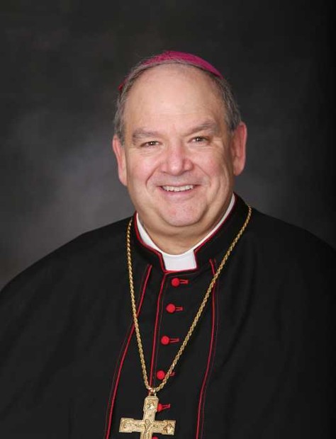
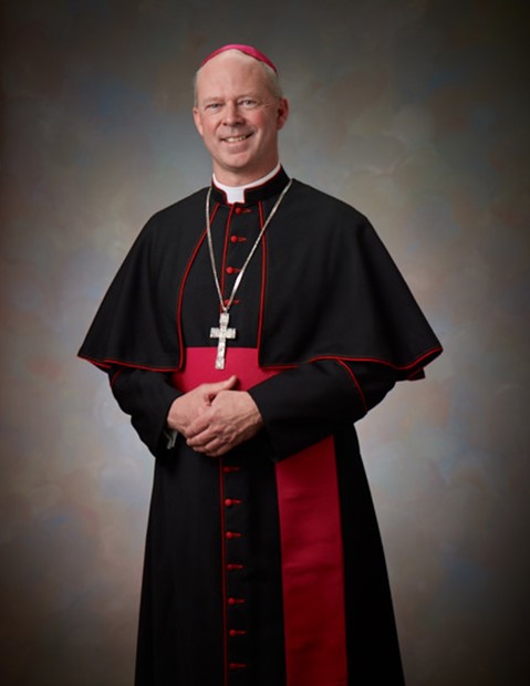
Bernard Hebda became Archbishop of Saint Paul and Minneapolis in 2016 after serving as its apostolic administrator. Born in Pittsburgh in 1959, he studied at Harvard and Columbia Law School and practiced law before entering seminary. Ordained a priest in 1989, he later earned a canon-law licentiate in Rome and worked for the Pontifical Council for Legislative Texts. He became Bishop of Gaylord in 2009 and coadjutor archbishop of Newark in 2013.
Patrick Neary, a priest of the Congregation of Holy Cross, became Saint Cloud’s tenth bishop in February 2023. Born in La Porte, Indiana, in 1963, he graduated from Notre Dame with a history degree and completed theology studies in Berkeley. Ordained in 1991, he served in campus ministry, including ministry to Latino students, and later led Moreau Seminary. His Holy Cross assignments took him to Kenya and Uganda, where he served as district superior.
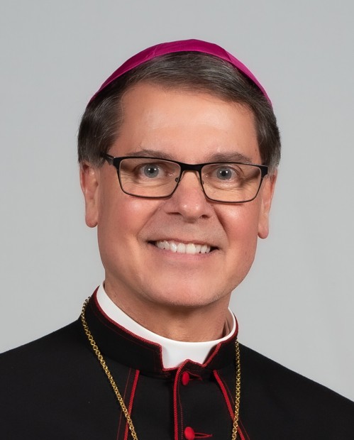
Daniel Felton became Duluth’s tenth bishop in May 2021. He studied religious studies and psychology at St. Norbert College, earned a theology master’s degree at Saint John’s University in Collegeville, and pursued further theology and communications studies in Rome. Ordained for Green Bay in 1981, he served Wisconsin parishes and worked for the Catholic Telecommunications Network of America. Before his appointment to Duluth, he had served as Green Bay’s vicar general and moderator of the curia since 2014.
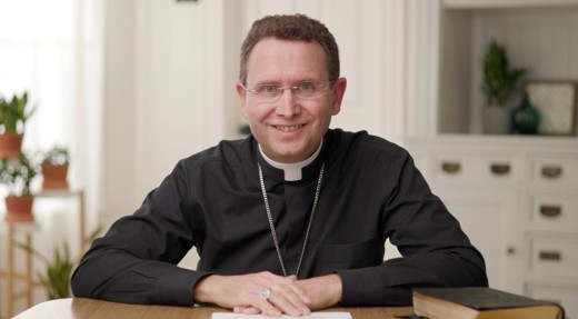
Andrew Cozzens was installed as Crookston’s eighth bishop in December 2021. A Benedictine College graduate, he worked with NET Ministries and Saint Paul’s Outreach before entering seminary. Ordained for Saint Paul and Minneapolis in 1997, he served in parishes, pursued doctoral studies in Rome, and worked in seminary formation. He became an auxiliary bishop of Saint Paul and Minneapolis in 2013.
Becker, Beltrami, Clay, Clearwater, Hubbard, Kittson, Lake of the Woods, Mahnomen, Marshall, Norman, Pennington, Polk, Red Lake, Roseau.
Official site confirms 14 counties and links diocesan map. Named list cross-check from secondary encyclopedia; remaining 14 counties in complete mutually exclusive 87-county partition. No explicit official named list found in accessible text. Label county-union reconstruction; do not call downloaded official GIS.
Generalized county-based reconstruction of present Latin diocesan territory. Not an official canonical or parish-boundary survey.
Chad Zielinski became New Ulm’s fifth bishop in September 2022, following service as Bishop of Fairbanks. Born in Detroit in 1964 and raised on a Michigan farm, he enlisted in the Air Force after high school before entering seminary. Ordained for Gaylord in 1996, he served parishes and Hispanic ministry before becoming an Air Force chaplain in 2002. His military service included assignments in Europe, Alaska and combat zones.
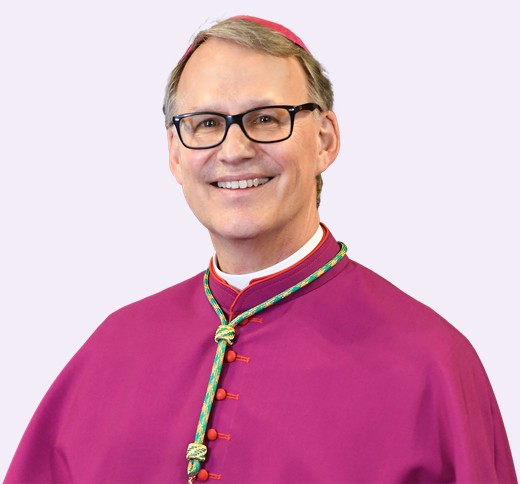
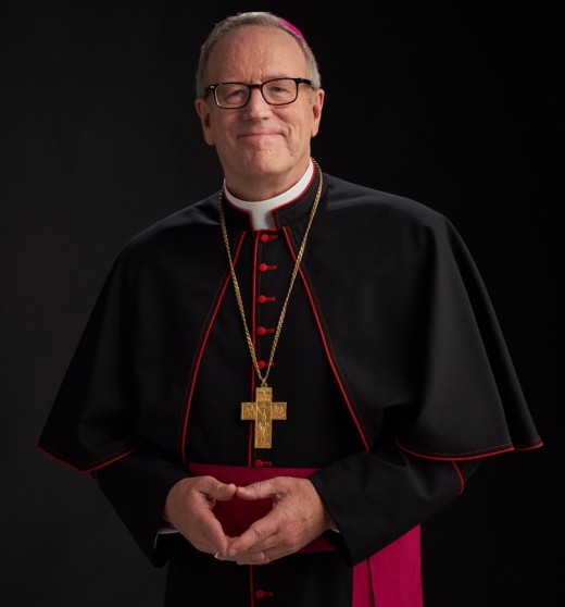
Robert Barron became Winona-Rochester’s ninth bishop in July 2022 after serving as an auxiliary bishop of Los Angeles. Ordained a Chicago priest in 1986, he earned advanced degrees in philosophy and theology and taught at Mundelein Seminary, later serving as its rector and president. He founded Word on Fire, a media ministry producing books, films and teaching programs, including the CATHOLICISM documentary series.
Michael Izen assists Archbishop Hebda as an auxiliary bishop. A Fairmont native and Saint John’s University graduate, he worked as a 3M systems analyst before entering Saint Paul Seminary. Ordained a priest in 2005 and bishop in 2023, he has served communities including Stillwater, Bayport and Lake St. Croix Beach.
Kevin Kenney assists Archbishop Hebda as an auxiliary bishop. A Minneapolis native, he studied business administration and Spanish at the College of St. Thomas. Ordained a priest in 1994, he served Twin Cities and southern Minnesota parishes and led Latino ministry. Appointed an auxiliary bishop in July 2024, he was ordained that October.
Bishops Michael J. Izen and Kevin T. Kenney assist Archbishop Hebda as auxiliaries. They do not lead separate Minnesota territorial dioceses. Eastern Catholic communities are also part of Minnesota’s heritage. Eastern Catholic parishes in Minnesota belong to overlapping eparchies whose sees are outside Minnesota. They must not be assigned ecclesiastically to one of these six Latin dioceses merely because they lie within its geographic footprint. This dataset does not claim complete Eastern eparchy territorial coverage. Saint Constantine, Minneapolis, for example, belongs to the Ukrainian Catholic Eparchy of Saint Nicholas in Chicago.
Cathedrals and basilicas
The Basilica of Saint Mary is both a co-cathedral and minor basilica, so categories overlap. Saint Stanislaus Kostka is a basilica, not a cathedral. Former cathedral buildings are not counted as active cathedral sites.
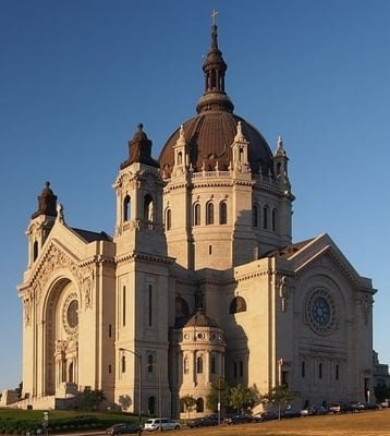
The cathedral traces its roots to an 1841 log chapel on the Mississippi bluff, whose dedication helped give Saint Paul its name. The present building, the fourth cathedral, was designed by Emmanuel Louis Masqueray and first hosted Mass in 1915. Its scale connects the river settlement’s beginnings with metropolitan Catholic growth and the prominent civic architecture of Archbishop John Ireland’s era.
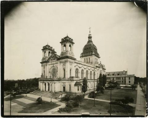
The Basilica of Saint Mary became the first basilica in the United States in 1926 and also serves as the archdiocese’s Minneapolis co-cathedral. Designed by Emmanuel Louis Masqueray, it belongs to the same ambitious building program as Saint Paul’s cathedral. Its architectural heritage offers a gateway to the Twin Cities’ immigrant Catholic history, sacred music, visual arts, and continuing parish life.
88 North 17th Street, Minneapolis, MN 55403
The official website reported the main upstairs nave closed for restoration at the September 14, 2026 check, with Mass in the lower level. Check mary.org for current access.
The active Cathedral of the Immaculate Conception was dedicated in 1990, continuing the episcopal role of an earlier Crookston cathedral dedicated in 1913. It serves a diocese spanning fourteen counties in northwestern Minnesota. Reading the two buildings together helps visitors distinguish a historic urban landmark from the present place where regional Catholic communities gather with their bishop for major diocesan celebrations.
Cathedral of Our Lady of the Rosary exterior in Duluth, MPR News file photograph. Dan Kraker / MPR News · Scaled for display.
Duluth’s cathedral is the mother church of a diocese extending across ten northeastern Minnesota counties. Its current shrine to missionary priest Monsignor Joseph Buh connects the building with the region’s Catholic missionary history. The parish’s music, education, and community ministries provide a contemporary counterpart to that history, linking Lake Superior’s urban center with Catholic communities across the Northland.
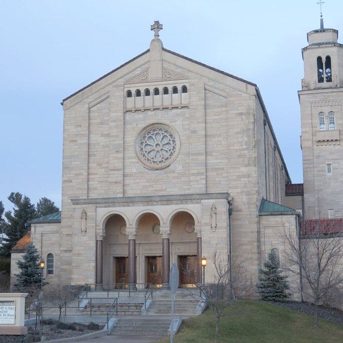
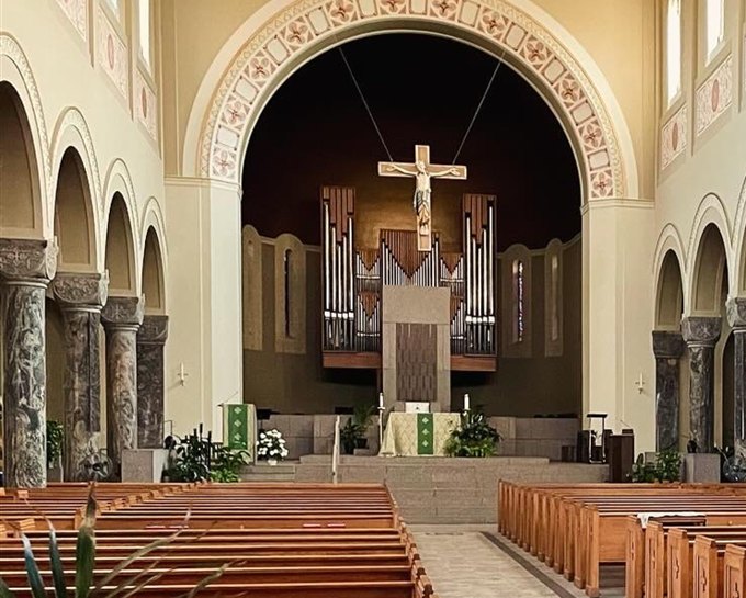
Saint Mary’s grew from a parish served by Benedictines from Saint John’s Abbey. After the earlier church burned in 1920, the community rebuilt; the upper church was completed in 1931. A second fire destroyed Holy Angels Pro-Cathedral in 1933, and Saint Mary’s became the cathedral in 1937. Its story connects community rebuilding with the Benedictine institutions that shaped central Minnesota’s religious and educational networks.
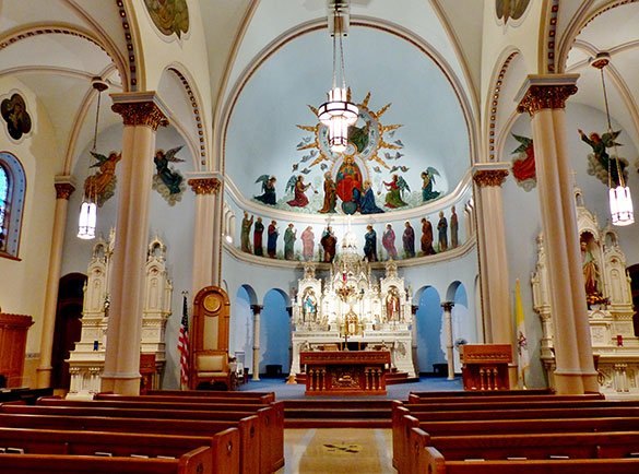
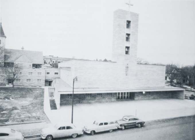
Holy Trinity’s present church followed the loss of an earlier building in the 1881 tornado. Its cornerstone was laid in 1890, with the steeple added in 1893 and interior decoration completed in 1903. German baroque influences and paintings by Alexander Schwendinger and his collaborators preserve the community’s artistic heritage. The church became the cathedral when the Diocese of New Ulm was established in 1957.
Sacred Heart Cathedral brought together the Saint Thomas and Saint Joseph parishes in 1952, joining communities with Irish and German roots. Saint Thomas had served as the diocese’s pro-cathedral after the diocese was created in 1889. This transition offers a local lens on how immigrant parishes in a Mississippi River city developed a shared diocesan center while retaining memories of their distinct communities.
Founded in 1863 as Rochester’s first Catholic church, Saint John’s has occupied the same downtown block throughout its history. The present church first hosted Mass in 1957 and became a co-cathedral in 2018. Its connection to Rochester’s pedestrian subway system gives patients, caregivers, residents, and visitors access from the medical district, linking parish heritage with the city’s continuing identity as a place of care.
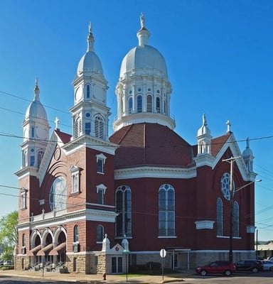
Kashubian Polish immigrants in Winona’s East End organized Saint Stanislaus Kostka parish in 1871. Many parishioners worked in nearby lumber mills and helped finance the large domed church dedicated in 1895. Elevated to a minor basilica in 2011, it preserves a powerful connection between riverfront labor, immigrant language, schooling, and religious community. Its “Polish Cathedral” architectural style does not make it a diocesan cathedral.
Interpretation: steamboat arrivals, Seidenbusch’s journeys and McGregor’s parish history show that transport shaped access to ministry. Holy Family’s later expansion for vacationers adds another layer: regional heritage grew through seasonal residents as well as permanent settlement. These are documented connections, not proof that a modern road follows an earlier missionary route.
Interpretation: diocesan boundaries organize Catholic administration; a river basin describes water flow, and a parish cluster organizes local cooperation. They are different geographies. Isanti’s links to Cambridge and Braham and Emily’s links to other lake-country parishes explain useful community relationships without assigning a religion or diocesan identity to every resident.
Tell service and accountability in the same history
Interpretation: schools, hospitals and community ministries are important Catholic contributions, while boarding-school harms also belong in the record. Lajimodiere’s account includes parents’ resistance and the Sisters of St. Benedict’s 2021 apology to White Earth. An inclusive guide should foreground Indigenous voices and living communities, with institutional achievements and responsibility both visible.
Sources, image credits and map methods · 94 references
Sources are linked to the claims they support. Official institutional accounts describe their own histories and are read alongside public and Indigenous historical sources. Metadata-only leads are identified in the notes; they are not treated as full-text readings.
MN015 · Pine River — Minnesota Pollution Control AgencyLake-rich landscape in portions of Aitkin, Cass, Crow Wing and Hubbard counties; do not imply entire Emily municipality verified within watershed without overlay Checked 2026-09-14.
MN016 · Northwest Trail — Jon Lurie, MNopediaSandy Lake–West Savanna–Savanna Portage–East Savanna–St Louis route, lower portages; keep total public paraphrase short Checked 2026-09-14.
MN028 · River of History, Chapter 6Indigenous names, spiritual meanings and river uses; notes limitations of Hennepin's account. Checked 2026-09-14.
MN029 · Our HistoryGaltier in 1840–1841; Diocese of Saint Paul in July 1850; Sisters of St. Joseph in 1851; archdiocese on May 4, 1888; boundaries in 1957; name and co-cathedral status in 1966. Checked 2026-09-14.
MN030 · Our HistorySt. Cloud foundation in 1857; move to St. Joseph in 1863; Duluth daughter monastery in 1892; schools, hospitals and continuing ministries; distinct institutional incorporation. Checked 2026-09-14.
MN031 · Native American Boarding SchoolsFamily separation, language and cultural suppression, parental resistance and lasting trauma; the 2021 Saint Benedict apology. Historical article last modified April 16, 2025. Its school counts and statements about federal recognition are time-sensitive and are not used as current facts. Checked 2026-09-14.
MN032 · Bishop Rupert Seidenbusch, O.S.B.Appointment on February 12, 1875; Collegeville abbacy; travel by wagon, buggy and railway; subsequent division of the vicariate. Checked 2026-09-14.
MN033 · Past BishopsDiocese of Saint Cloud established in 1889. The inspected official history supplies the year; the guide does not assert a month and day. Checked 2026-09-14.
MN034 · A Brief History of the Diocese of DuluthNorthern vicariate in 1875; Diocese of Duluth on October 3, 1889; ten northeastern counties and present ministries. The page's separate 1835 Baraga incident date is not used without additional verification. Checked 2026-09-14.
MN035 · Our HistoryCotter in 1889; diocesan name and Rochester co-cathedral designation on January 23, 2018; existing Winona cathedral. Unused passages contain apparent errors concerning the 1680 missionary identification, tornado date and the 1889 hospital's name. Checked 2026-09-14.
MN036 · History of the Diocese of CrookstonDiocese erected from Saint Paul on December 31, 1909; first bishop Timothy Corbett and institutional growth. The page's separate 1875 archdiocese date and first-priest claim are not used. Checked 2026-09-14.
MN037 · HistoryDiocese erected on November 18, 1957; first bishop named on November 28. Checked 2026-09-14.
MN039 · St. Emily’s Catholic ChurchSt. Emily's Minnesota foundation in 1951; Diocese of Duluth affiliation; Northern Lakes Catholic Mission Field; parish address. Checked 2026-09-14.
MN040 · Aitkin County CatholicHoly Family in McGregor, St. James in Aitkin and Our Lady of Fatima in McGrath; local ministry links. McGregor's address differs between official sources. Checked 2026-09-14.
MN041 · History of Holy FamilyHoly Family's 1915 building, 1938 incorporation, Crosier ministry from 1948 and 1961–1962 summer church. Unverified railway-company titles and other early biographical claims are not repeated. Checked 2026-09-14.
MN042 · ParishesOfficial diocesan listing for St. Elizabeth Ann Seton in Isanti. Checked 2026-09-14.
MN043 · Parish FinderConfirmation of St. Emily in Emily and Holy Family in McGregor; parish websites; McGregor address discrepancy. Checked 2026-09-14.
MN049 · Bishop Daniel J. FeltonCurrent role; concise biography; May 20, 2021 episcopal ordination; official image; heraldic water theme. Checked 2026-09-14.
MN051 · About the Diocese of New UlmCurrent bishop Zielinski; July 12, 2022 appointment and September 27, 2022 installation. Checked 2026-09-14.
MN052 · Most Reverend Chad W. Zielinski BiographyEarlier life, Air Force and parish ministry; Fairbanks consecration. Retains former Fairbanks wording so not used alone for current office. Checked 2026-09-14.
MN054 · Meet the Bishop — Robert BarronCurrent role; June 2, 2022 appointment; concise biography; three official portrait downloads and media kit. Checked 2026-09-14.
MN055 · Bishop Michael IzenCurrent auxiliary office; appointment and ordination; Collegeville/3M background; former St. Croix area parish service; official portrait link. Checked 2026-09-14.
MN056 · Bishop Kevin KenneyCurrent auxiliary office; 2024 appointment and ordination; concise biography and Latino ministry; official portrait link. Checked 2026-09-14.
MN060 · U.S. Census Bureau: 2026 county boundariesJanuary 1, 2026 geography; all 87 Minnesota counties queried in WGS84, generalized at 0.0005 degrees. Diocesan assignments come from separate territorial descriptions. Checked 2026-09-14.
MN061 · U.S. Census Bureau: 2026 transportation geographyPrimary and secondary interstate, US and state roads in the Minnesota bounding box, generalized at 0.003 degrees. Used as geographic context in guide maps. Checked 2026-09-14.
MN068 · Diocese of Crookston territorial referenceOfficial site confirms 14 counties and links diocesan map. Named list cross-check from secondary encyclopedia; remaining 14 counties in complete mutually exclusive 87-county partition. No explicit official named list found in accessible text. Label county-union reconstruction; do not call downloaded official GIS. Checked 2026-09-14.
MN069 · Diocese of Crookston territorial referenceOfficial site confirms 14 counties and links diocesan map. Named list cross-check from secondary encyclopedia; remaining 14 counties in complete mutually exclusive 87-county partition. No explicit official named list found in accessible text. Label county-union reconstruction; do not call downloaded official GIS. Checked 2026-09-14.
MN070 · Diocese of Crookston territorial referenceOfficial site confirms 14 counties and links diocesan map. Named list cross-check from secondary encyclopedia; remaining 14 counties in complete mutually exclusive 87-county partition. No explicit official named list found in accessible text. Label county-union reconstruction; do not call downloaded official GIS. Checked 2026-09-14.
MN071 · Diocese of Crookston territorial referenceOfficial site confirms 14 counties and links diocesan map. Named list cross-check from secondary encyclopedia; remaining 14 counties in complete mutually exclusive 87-county partition. No explicit official named list found in accessible text. Label county-union reconstruction; do not call downloaded official GIS. Checked 2026-09-14.
MN094 · Bishop KenneyAppointment and episcopal ordination; publicly published real portrait explicitly credited to The Catholic Spirit / Archdiocese. Checked 2026-09-14.
Photographs
Photographs identify the people and buildings discussed here. Each retains its source and credit. An attribution is not an open license or an endorsement of Spark House. Reuse beyond this guide must follow the individual source’s terms.
Archbishop Bernard A. Hebda: No unrestricted license verified. The Archdiocese identifies Dave Hrbacek/The Catholic Spirit and offers its official JPG for free download/printing by parishes, schools and Catholic organizations, with no sale. That specific permission is not an unrestricted general web license. Preserve this credit for editorial identification. Photo source.
Bishop Patrick M. Neary, C.S.C.: Published on the official bishop page. No explicit open license or general republication grant was identified; retain attribution and source link. Do not label as public domain or permission granted. Photo source.
Bishop Andrew H. Cozzens: The public Formed source page states Copyright 2024 Augustine Institute. All Rights Reserved. No open license or explicit general reuse grant verified. Preserve publisher credit and source for editorial identification; do not label this photo CC-licensed. Photo source.
Bishop Daniel J. Felton: No open license or explicit reuse grant verified. This is a publicly published portrait identified in an article by/about Bishop Felton, not a generated illustration. Preserve the publisher/source citation for editorial identification; do not mark it CC-licensed or public domain. Photo source.
Bishop Chad W. Zielinski: The bishop announcement page offers a High Resolution Photo download with its media materials. No explicit open license was found. Preserve provenance and attribution; no public-domain or unrestricted-reuse claim. Photo source.
Bishop Robert E. Barron: No open license or explicit reuse grant verified. A public Catholic parish page identifies the image as Bishop Barron and links his Word on Fire ministry. The separate Word on Fire press kit offers photographs but its permissions must not be assumed to apply to this specific file. Preserve source credit for editorial identification. Photo source.
Bishop Kevin T. Kenney: Source explicitly supplies Catholic Spirit / Archdiocese photo credit. No unrestricted reuse license verified; parish page reserves rights. Preserve credit for editorial identification. Photo source.
Cathedral of Saint Paul: CC BY-SA 3.0 Institutional republication is resized; credit creator, source page and license. Additional crops/edits must be identified and follow share-alike license. Photo source.
The Basilica of Saint Mary: Item rights could not be retrieved; no open reuse license established This manifest records a public published image and its source. Download success does not establish an open license or permission for republication. Photo source.
Cathedral of Our Lady of the Rosary: No open reuse license found This manifest records a public published image and its source. Download success does not establish an open license or permission for republication. Photo source.
Cathedral of Saint Mary: No open reuse license found This manifest records a public published image and its source. Download success does not establish an open license or permission for republication. Photo source.
Cathedral of the Holy Trinity: No open reuse license found This manifest records a public published image and its source. Download success does not establish an open license or permission for republication. Photo source.
Co-Cathedral of Saint John the Evangelist: No open reuse license found This manifest records a public published image and its source. Download success does not establish an open license or permission for republication. Photo source.
Basilica of Saint Stanislaus Kostka: CC BY-SA 4.0 Institutional republication is resized; credit creator, source page and license. Additional crops/edits must be identified and follow share-alike license. Photo source.
A family photograph, a church ledger, a remembered Main Street, or a working piece of farm machinery can make a place’s history tangible. Spark House helps gather and preserve the materials and memories still held by neighbors.
Contributors choose how their materials may be credited, displayed, or shared with the Isanti County Historical Society. Submissions go to Spark House for review before anything is added to this atlas.
Photographs, maps and census counts reveal different parts of a community’s history.
Find a theme or search the stories
At the archive desk
Dates and qualifiers follow the archive. A photograph’s subject, a person’s regional connection, and the place it was taken can differ. Each caption states the relationship supported by the record.
How did the recorded population change?
Compare up to two cities using decennial census counts. Use the growth index to compare relative change between places of different sizes.
City boundaries can change. A larger census count alone does not show whether the cause was annexation, migration, births or another change. These are municipal totals, not constant-area measurements.
Exact counts, revisions & comparison notesA different scale: age 65+ in the state and focal counties
This is separate state or county context, not an age profile of the selected city.
Patterns to exploreKeep exploring the archives
Collection coverage is uneven. Linked catalogues may contain further records that have not been read or reproduced here. Some materials need an archive visit or separate permission.
Follow settlement, incorporation, community milestones and population records. These municipal beginnings sit within a much longer Indigenous history.
Dates & population sourcesHow to compare these records
A Census count describes the geography and enumeration date used for that census. Annual estimates use their stated reference date, method and vintage; a newer estimate series may recast earlier years to newer boundaries. A population jump can reflect annexation, consolidation or a changed statistical area as well as changes in residents.
Missing records are not zero. Township, city, village and census-designated place totals remain separate. Settlement, platting, township organization and municipal incorporation are different events; their original date precision is retained.
Each community’s history links to the local institutions, historical societies, and other references behind it. The map adds contemporary geography from the U.S. Census Bureau and USGS.
The original 22-community package includes narratives, references, map cards, boundaries, and an ArcGIS StoryMap setup guide. The wider regional connections view is an additional layer and is not included in this earlier package.
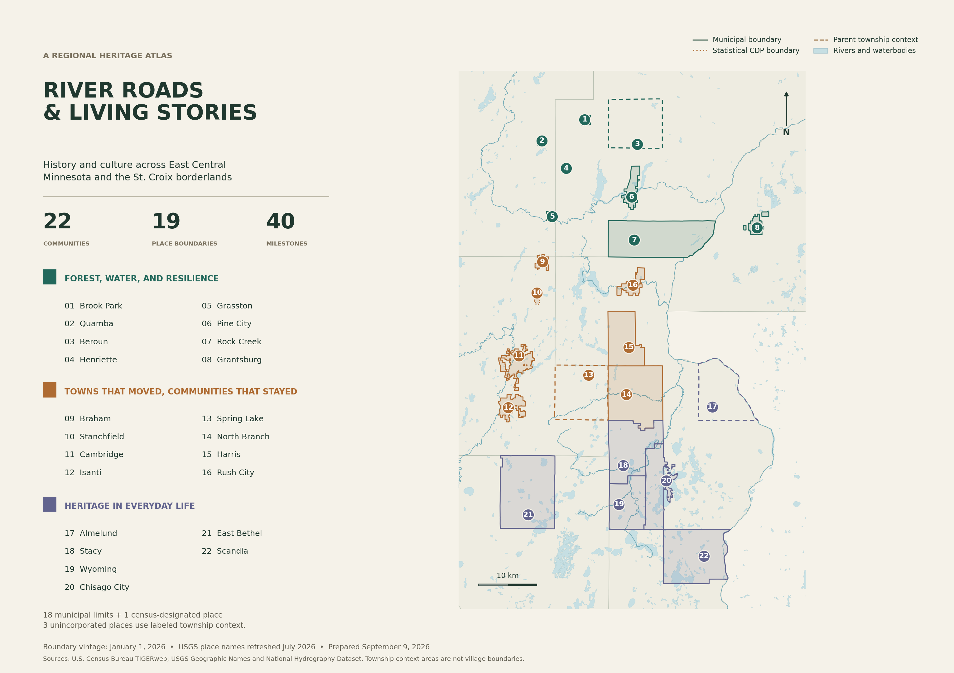
Full place polygons and township context, with rivers and lakes. Original cartography using Census and USGS geography.
Reading the boundaries
18 municipal boundariesFull incorporated-place polygons.
Stanchfield CDPA statistical community area, distinct from the larger township.
Three township context areasMission Creek for Beroun; North Branch Township in Isanti County for Spring Lake; Amador for Almelund. These are broader areas than the named settlements.
Geography, dates, and location precision
Boundaries are full January 1, 2026 Census geographies, with detached areas and holes retained. Community display points come from USGS Gazetteer records refreshed in July 2026; they are not visitor entrances.
Rivers are selected named NHD flowlines within the regional study window. Lake polygons remain complete; the selection includes waterbodies with source area of at least 0.02 km². These layers provide regional context rather than an exhaustive drainage inventory.
Supplementary heritage sites use approximate street-address locations or mapped feature centers. Stanchfield Baptist Church’s text is retained in the dataset’s unlocated-sites table because its location was not verified.
The 22 communities follow the researched guide. Grantsburg and Scandia were likely cropped labels on the source map; their actual geographic identities are verified. One unreadable label was not assigned a place.
Editorial chapter groupings are not historical or cultural territories. This map is for interpretation, not a parcel survey or regulatory zoning determination.